Loading ranch…


Lot 51
$175,004
$849/acre
206.13 acres · Pumpville Ranch Subd34 of 37 tracts left · 1 sold in the last 30 days
206.13 AcresSeasonal CreekCreek FordExisting Ranch RoadPartial FencingOwner Finance
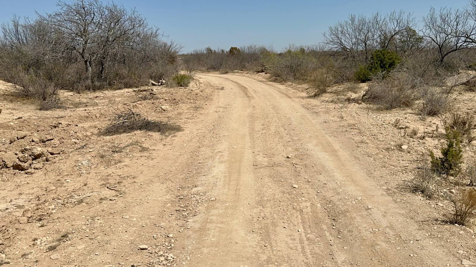
Begin at the southwest corner, where the dirt ranch road finally quits. Wire stands along the south and the west, over half the southern length and a good share of the western one, though where that wire sits relative to the surveyed line is the survey's business and not the wire's. The south end holds the good part: a creek bed cuts across it for a bit over 1,100 ft, with a shorter arm of the same drainage clipping the southern boundary before it leaves. Shape matters here. To the north the land lifts into sparse caliche flats, and the road enters at the north boundary and travels the full length of the tract, something near 5,620 ft of it, before ending back at that southwest corner. All told that's Tract 51, 206.13 acres of ranch land for sale on Pumpville Ranch in Val Verde County, Texas.
The creek bed is what you'll remember a week later. Step past the thicket on the bank and the air changes temperature on you. Big trees lean in from both banks until the sky narrows to a strip of blue, the cut banks stand chest deep in spots, and at the lowest point of the bed a pond lies with its edges printed by hooves. Cattle stay in there for the shade, and the result is a floor of grass trimmed as short as a mowed yard, soft to sit on and clear to see across. The shade in there holds the heat off better than anywhere else on this 8,630-acre ranch. A picnic spot. A camp. What the bed is holding depends on the weather, and that's an honest thing to say out loud, so we'll stand in it with you and you can see for yourself what it's doing the week you're there.
A creek crossing sits at the south end where the track crosses the creek bed, a hard-bottomed crossing worn in by trucks and cattle over the years. That crossing is what ties the upper part of the tract to the shade without a culvert or a day's work with a shovel. The road itself is an old ranch road and nothing more; the deed and the recorded plat govern what access you hold, and we'll point you to both. What it means on the terrain is simple enough: you can drive a pickup from the north boundary to the creek crossing and on to the southwest corner without cutting a new track. Easy driving when it's dry.
Above the bed the land climbs some 73 ft, from near 1,907 ft at the lowest to 1,980 ft at the top, and the character changes entirely as you gain it. Caliche and flat rock, cedar standing dark against pale soil, prickly pear and yucca spaced out like somebody set them there. Thorny thickets bunch heaviest in a band from the west line across to the southeast corner, and the balance is sparse enough that you can see a long way and pick your own path on foot. A low rim shows on the horizon. Anybody planning a camp would do well to set it up top where the breeze works and the soil drains, and keep the creek bed a short ride away for the shade in July.
This is the far end of Val Verde County, west of Del Rio, in the broken terrain the old Sunset Route crossed on its way to El Paso. The name here was earned plainly: in 1887 wells were drilled 600 ft deep and a pump house built to water steam locomotives, and a stop called Samuels turned into Pumpville. Diesel ended that. The depot closed in 1952, the water quit in 1955, and the townsite settled into being a ghost of itself, which left behind the one thing this part of Texas still has in quantity. Langtry, where Judge Roy Bean held his court, is in the same stretch.
Boundaries are surveyed and the tract carries an agricultural valuation earned the old way, by cattle grazing it, which holds the annual tax figure where a landowner wants it. Confirm the current standing with us before you count on it. Owner financing is on the table, starting at 5% up front. Anything you need settled before you buy, water, power, a building site, title detail, we would rather you verify it than take our word for it, and we'll hand you what we have. Wear boots you don't mind ruining, since the bed stays muddy a good while after a rain, and tell us you want to see the pond hole first. Everything else on Tract 51 reads differently once you've stood in that shade.
Where Lot 51 sits
Tap a 360° pin to stand on the land and look around.
Similar lots
Lot 51 — common questions
- Is Lot 51 at Pumpville Ranch Subd still available?
- Yes — Lot 51 is listed and openly available at $175,004. Inventory moves; booking an appointment or calling (830)-307-7533 is the fastest way to hold your place.
- Can I buy Lot 51 at Pumpville Ranch Subd with owner financing?
- Ask us — Guadalupe Ranch Co. is the owner-seller and finances most tracts in-house with low down payments and no bank qualifying. Call (830)-307-7533 for this lot's options.
- How big is Lot 51 at Pumpville Ranch Subd and where is it?
- Lot 51 is 206.13 acres at Pumpville Ranch Subd in VAL VERDE County, Texas. It's surveyed with deeded access on graded ranch roads.
- Can I walk Lot 51 at Pumpville Ranch Subd before buying?
- Yes — book an appointment right from this page (takes about a minute) or call (830)-307-7533. A guide who knows the ranch will meet you at the gate and walk the corners with you.